- May 17, 2021
- Auriane Espeut
- Underwater drone news
- 0 Comments
The digitalization of seabeds is today’s reality.
Bathymetry, known as the science of seabed topography, makes it possible to map any seabed relief with high precision. Even though the science in itself is centuries old, the technological advances of last few decades regarding underwater surveys have propelled bathymetry forward.
As a key stage in the development or maintenance of underwater infrastructure, the collection of bathymetric data is a difficult task that requires evermore precise surveying technology.
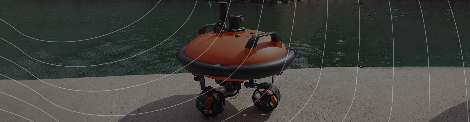
Faithful to its vision of improving access to underwater data, Notilo Plus has developed Seasam Navigator, an autonomous motorized buoy which used to create bathymetric mappings of GPS-defined areas. Thanks to its single-beam echo sounder, the buoy is therefore able to provide information with an accuracy of around 20 centimeters on a water column.
This mobile and easily deployable bathymetry solution mainly appeals to marinas, but also draws the attention of other port industries players and even cruise ship owners. The use of this buoy – associated with a ROV – makes it possible to easily obtain topographic data and images allowing to achieve, among other things:
siltation-related dredging controls,
port infrastructure monitoring,
numerical modeling prior to underwater work (layout of a tunnel, pipeline or bridge),
geotechnical and maritime engineering studies,
expansion projects or creation of anchorage areas,
seagrass monitoring studies,
seabed inspections to identify new potential anchorage areas.
Bathymetry is a complex science, today mainly practiced by specialized service providers. Although the maps provided by hydrographic and oceanographic services (like SHOM in France) are very useful and widely used in the maritime environment, they do not provide precise data on all of the covered areas. Thus, resorting to an autonomous and high-precision bathymetric solution would allow marinas to gain independence, speed and flexibility in the management of their submarine projects.
In a matter of minutes, Seasam Navigator is able to collect GPS and acoustic data which are afterwards sent and processed through the Notilo Cloud platform. While carrying out bathymetric surveys, the application offers the possibility of adding on-the-fly annotations to the identified points of interest, when its use is coupled with a Seasam drone.

There is no doubt that underwater drone technology, far from replacing human know-how, is a tool of high added value which, by saving time and money, allows greater agility with what’s happening underwater. Last but not least, it ensures the safety of the divers dedicated to underwater work.